Major fault 1,300 km long along California coast
The state of California on the west coast of the United States is known as an earthquake-prone area. On the coast of California facing the Pacific Ocean, there is the San Andreas Fault, a major fault that stretches 1,300 kilometers long.
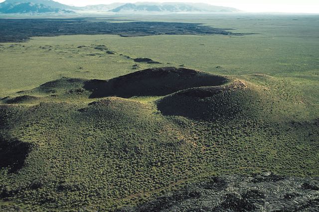
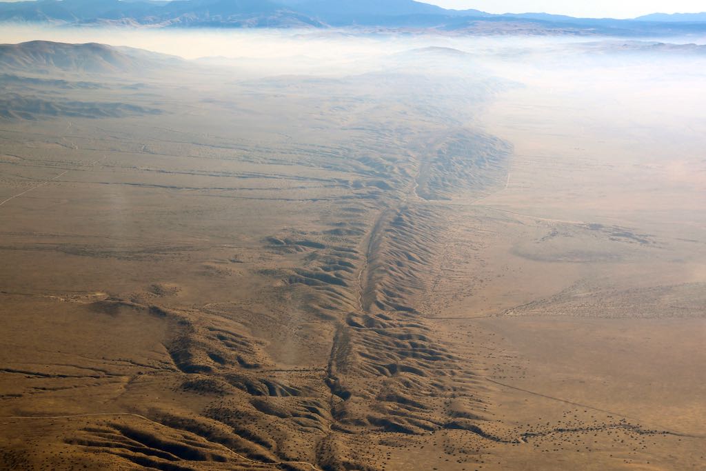
Take a look at the photo at the beginning of this article. This photo shows the fault line as seen from the sky over the Carrizo Plain, about 160 kilometers north of Los Angeles. In the center of the photo, there is a hilly area that stretches out like the spine of an animal, and a clear valley is formed in the center of the hilly area.
This part of the valley is the San Andreas Fault. Since the Carrizo Plain is a semi-arid area with few trees, we can often observe the shape of these faults. The hillside is a geological structure called a “pressure ridge,” created by the two sides of the fault pushing against each other, and this type of hillside extends for about three kilometers.
The San Andreas Fault is a horizontal shifting fault called a “strike-slip fault“. A strike-slip fault is basically a fault that shifts horizontally, so it does not “push” against each other. But even so, locally there is a compressive force, and this is how the raised topography is formed in some parts of the fault.
Strike-slip faults form at the boundaries of plates that move in opposite directions
The San Andreas Fault is at the boundary of two plates, the Pacific Plate and the North American Plate. To the west of California is the Pacific Plate, which is an oceanic plate that covers a large area of the Pacific Ocean. The North American Plate to the east is a vast continental plate that includes the North American continent, Greenland, and even parts of Siberia, and eastern Japan is part of this plate.
At the San Andreas Fault, these two plates are in contact, but because the Pacific Plate on the west side is moving toward the northwest, this area is horizontally “strike-slip”. If you stand on the North American Plate side in California and look at the Pacific Plate to the west, you will see that the Pacific Plate has shifted to the right. That’s because the Pacific Plate is moving northwest, right?
On the other hand, if you were to look at the North American Plate on the Pacific Plate moving in a northwesterly direction, the North American Plate would still be shifting to the right as you face it. In other words, no matter which side of the fault you stand on, the other plate is still shifting to the right.
In this way, when a person standing on one side of the fault looks at the other side of the fault, a lateral shift fault where the other side shifts to the right is called a “right-lateral fault”.
With this in mind, look at the picture at the beginning again. You can see several rivers flowing across the fault.
For example, if you look at the right half of the photo (to the right of the fault), you can see a relatively large river in the foreground. If you follow this river from the right side of the picture toward the fault, you will see that it bends greatly at the fault. After it snaps to the upper side of the photo, it extends to the left again on the other side of the fault.
This bending of the river is actually evidence of a right-lateral fault. After the river crossed the San Andreas Fault, the river channel was bent because the fault moved sideways. And if you look at the river on the other side from one side of the fault, you can see that the flow path of the river is properly shifted to the right.
The great earthquake of 1906 that devastated San Francisco
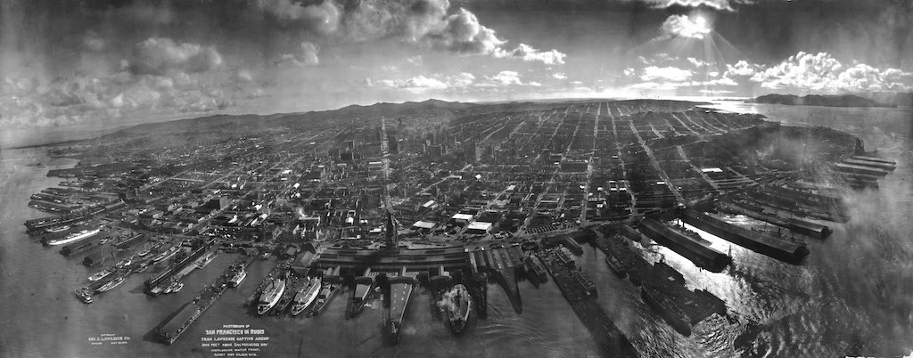
The San Andreas Fault has caused major earthquakes in California many times, but the San Francisco Earthquake of 1906 was the most devastating. The magnitude of the earthquake was 7.8 on the Richter scale, and it devastated the city of San Francisco, which was then a new city, and the earthquake and subsequent fires killed more than 3,000 people, making it a historic disaster.
The San Andreas Fault is roughly divided into “northern,” “central” and “southern” sections, and the San Francisco Earthquake was a major earthquake that occurred in the northern section. Another major earthquake in the northern section was the Loma Prieta Earthquake in 1989. In addition, in the central section, the Fort Teflon Earthquake occurred in 1857 with an estimated magnitude of 7.9 on the Richter scale.
Under these circumstances, earthquake researchers have long been concerned about a major earthquake in the south section. Unlike the northern and central sections, the southern part of the San Andreas Fault has not had a major earthquake for at least 300 years, and it is believed to have accumulated a lot of seismic energy. Like Japan, the United States is on alert for a major earthquake in the future.
References
Katsuaki Watanabe (2020) Utsukushisugiru chigaku Jiten (Handbook of the Most Beautiful Geological Wonders), Tokyo: Shuwa System [published in Japanese].

Location
Translated with www.DeepL.com/Translator (free version)